


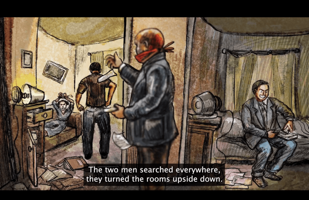
Between Mapping and Art: The Tubas Master Plan in the West Bank
https://doi.org/10.71609/iheid-8h6d-cx20During my research on master planning in Palestine, I have observed how Palestinian professionals have meticulously surveyed the West Bank and Gaza, compiling geospatial datasets on Palestine’s geography and social conditions, and how they have created master plans for future Palestinian villages or regions. I have examined how Palestinian master planning has served several functions: deflecting the occupiers’ bulldozing of Palestinian villages, increasing international pressure on Israel, as well as genuinely aiding Palestinian communities. However, I have noted that these state-making tools have only occasionally expanded to encompass the entire West Bank and Gaza to reflect Palestinian futures not solely shaped by the occupier. Despite – or perhaps because of – the epistemic determinism inherent in orthographic language, the few more extensive maps that have been produced have often become performative displays of unrealistic hope. When Palestinian planners’ visions have extended to include the whole West Bank and Gaza, these visions have inevitably intersected with the politics of the ongoing Palestinian-Israeli conflict. Through historical, positional and theoretical analysis, I began to see that even within this realm, the most carefully produced orthographic imaginaries can – simply by taking on a regional dimension – move from engineering documents towards something more akin to art.
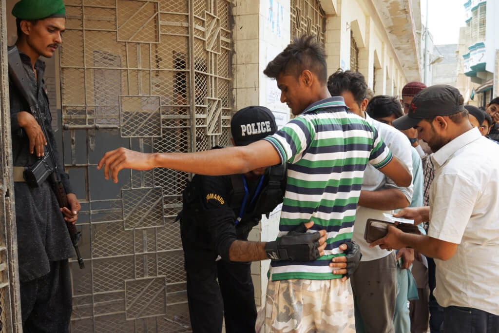
Palestinian master planning has served several functions: deflecting the occupiers’ bulldozing of Palestinian villages, increasing international pressure on Israel, as well as genuinely aiding Palestinian communities Palestinian urban planning originated as a vital response to Israeli aggression against Palestinian communities under occupation since 1967. By the mid-1980s, Israel increasingly employed planning methods to delineate the Palestinian presence in the West Bank. In response, some Palestinian diaspora engineers, having received training in urban design in Europe and America, returned to the occupied West Bank to use orthographic representations as a defence against the rising threats from the Israeli Military Administration. Emphasising an ethos of objectivity from the outset, Palestinian planners have attempted to counter the occupiers’ geospatial constraints and land grabs. Essentially, Palestinian planning practice has been intertwined with the historical material accumulation of settler colonialism (Meiton 2019; Roy 1999; Wolfe 2006; Said 1979; Halper 2006a; 2006b), further challenging the semantics of “remaining unnamed” (Khalidi 2020; Said 1979), a term that, in the Palestinian context, means remaining unmapped or misrepresented by Israel.
Since the Oslo Accords, under which nearly 61% of the West Bank was designated as Area C – territory under Israeli military and administrative control – the Palestinian communities in Area C have frequently requested that Palestinian planners craft urban proposals on their behalf and submit them to the Israeli Civil Administration (ICA). The planners are required to engage with the occupying administration, using their aesthetic formats (the so-called “Blue Line” plans) and adhering to their laws. Over time, Palestinian planners have learned to utilise map aesthetics as. Furthermore, Palestinian civil engineers and planners have increasingly adopted mapping as a way to continuously document and recognise Palestinian livelihoods (as well as those being destroyed by Israeli bulldozers). To counterbalance the unequal power dynamics in play, they have anchored their practice in universal cartographical standards, objectivity and professional collaboration with colleagues worldwide. Yet, despite the excellence of its geospatial datasets, Palestinian planning has remained limited, confined to Palestinian cities in Area A (under control of the Palestinian Authority) and a few hundred villages in Area B (administered by the PA but under Israeli military control). It has not evolved into a broader vision of Palestine.
In my research, I identified only two historical efforts to visually represent a Palestinian State, both made in the 1990s when hopes for peace were high. Since then, the consensus around Area C has remained unchanged, with community needs in this 61% of the West Bank managed by the Israeli Civil Administration. By 2016, however, the gradual Palestinian planning efforts by ministers, international actors, NGOs, and consultancies had accumulated into a patchwork of regional plans. These plans, when combined, created a composite image of a future Palestinian State.
I observed the development of one of the master plans that contributed to the later collection of Palestinian regional plans. The Tubas Cluster Plan was a boldly reasoned proposal, based, like all the plans I studied, on careful analysis and attention to the reliability of surveys in the West Bank and Gaza. Unlike most of the Blue Line plans, however, it featured a particularly daring mapped possibility – one without the occupier. Among all the orthographic imaginaries I encountered during my fieldwork, this was the most visually captivating and significant – it demonstrated continuity between regions, connecting areas and shaping a unified, harmonious Palestinian land. The regional plan’s aesthetics differed from those of the Blue Line plans handled by the ICA, and this aesthetic aimed at a different political objective – not to dispute with the ICA but to demonstrate confidence that the Palestinian political elite can realise what the plan envisions.
Established in 1984, the Center for Engineering and Planning (CEP) was formed to provide planning and engineering services in Palestine and has been involved in many development projects in the West Bank and Gaza. The CEP was involved in preparing a master plan for land usage within the Tubas Governorate in the northern part of the Jordan Valley, a plan which is a deterministic visualisation of reason both in its scope and in its aesthetics. The composition of surveys, lines and colours – the fusion of knowledge with aesthetics – has disrupted multiple status quos. The plan rejected the division of the West Bank into Areas A, B, and C, as established by the Oslo Accords, and it also rejected the aesthetics of the “Blue Line” plans demanded by Israel. Instead, the plan opposed the accumulated material structures and infrastructures of occupation, denying Israeli dominance over the planning process. The Tubas Plan was thus both a visualised aspiration for land usage and a political act of defiance against occupation.
An ethos of objectivity among the Palestinian planners permitted this daring visual to be drawn. However, instead of seeing the visual as a logical proposition, many Palestinian beneficiaries of this plan came to discredit the Tubas Cluster Plan as disconnected from the “reality on the ground” and hence unachievable. Unlike the ICA, the Palestinian mayors and ministers acknowledged the professionalism of Palestinian planners, but they did not welcome the proposal, dismissing it as merely a visualisation of wishful thinking. Palestinian communities and authorities misunderstood the plan’s orthographic determinism as an unrealistic aesthetic dream. This part of the connected West Bank appeared clouded by unspoken hesitation and disbelief, contributing to the plan’s declining acceptance.
Following the ethnography of the Tubas Cluster Plan, I encountered a new analytical challenge. Since this plan’s aesthetics played a different political role compared to the Blue Line plans, my thinking and writing needed to further consider both the deterministic and aesthetic qualities of planning practice. I developed a theoretical framework to unify logical practice and imaginative expression, giving both art and orthography equal epistemic value.
I argued that the orthographic projection used to draw maps is grounded in references to reality. Surveys capture natural and man-made phenomena and record them as dots, lines and polygons on a geospatial information system. Maps are, therefore, primarily sign systems (Peirce 1992) and a language (Saussure 2011), used not only for describing reality but also as a system of logical propositions (Russell 1905). When Palestinian planners communicated their projects, they fought for their semantic “truth value” (Frege 1980 [1879], 63) with meticulous attention to detail. In CEP’s narrative of a prosperous future of the Tubas region, the planners advanced an emancipatory imaginary that was in tension with the logical, deterministic practice of planning. At this intersection of surveying and urban design, I explored linguistic concepts often employed in art studies: “imagination” and “desire”. The common linguistic qualities of maps and art allowed for this theoretical connection and brought me closer to theories of signification in Žižek’s sense (2008), or imagination in Butler’s sense (1997), as emancipatory artistic formations.
Although, according to logical standards, the Tubas Cluster exemplified a deterministic aesthetic, accurate in its semantics, the plan was also a surface of imaginary “disorder”, a site of “contested identity” (Butler 1997, 7) caused by misrecognising the presence of Israeli installations. The plan revealed an escape from subjugation achieved through the pre-emptive insertion of one’s own meaning into reality, in line with Žižek’s proposition regarding signification at the level of the sign. The plan envisions “subjective destitution”, a radical return to reality as the starting point for new ideological formation (Žižek 2008, 263). The realisation of orthography enabled a radical reformulation on paper, where there was never an occupation to consider. In the urban design for the Tubas Cluster, the CEP created a subjective space for a striking visual depiction of alterity, opening a horizon for contemplating beyond the narrow scope of possibilities, and warning against limiting the consideration of Palestinian lives to oppressive facts and structures. The map challenged the “deferred future” (Roy 2016), not on a material level but on the level of representation.
THE TUBAS MASTER PLAN THUS ACTED AS A LOGICAL DETERMINANT OF LIVED ALTERNATIVES, PRESENTING A PLAUSIBLE VISUALISED ASPIRATION. The composition was as robust as the data it was based on. The aesthetic expression of the Tubas Cluster Plan never conflicted with the survey data, the planning method, or the map’s fundamental logic. My interlocutors believed that an accurate representation, grounded in precise and detailed geodetic surveys, supports the logical determination of a free Palestine. The Tubas Master Plan thus acted as a logical determinant of lived alternatives, presenting a plausible visualised aspiration. The plan pressed the aesthetics of logic as well as the “disruption” of “needing to think through Oslo”.
In the presentation of the Tubas Cluster plan, the Palestinian ministries and community mayors did not dispute the logical strength of the plan, but they still found aspects of its depiction—the portrayal of a prosperous, interconnected region—incomprehensible. However, this hesitation regarding the plan’s feasibility, given the idea that the orthographic imaginary combines logic and art, had an innate negative effect—the decline of one diminishes the other. In other words, the aesthetics of “no Oslo,” once deemed unfeasible, inevitably impacted the plan’s internal logical components, eroding the conviction that the connected region can be rationally envisaged. The plan’s shift into art during its presentation conveyed something profoundly nuanced: the dynamic of erasing the Palestinian representations from their deterministic significance.
And yet, in viewing planning as both science and art, I developed further interpretations. Palestinian maps, seen equally as logical propositions and artistic acts that are pre-emptive, disruptive and anticipatory, continued to support Palestinian self-determination. A Palestinian aesthetics of misrecognition, this bold form of representation, extended beyond mere artistic “anticipatory representation” (De Cesari 2012) and reached into ministerial offices and community meetings, functioning both as a deterministic scientific diagram and an aesthetic statement. It was not simply cynical (Allen 2013) or purely aesthetic (De Cesari 2012), but a logical illustration of Palestinian geographical unity and the realm of possibilities for inhabiting it. Consequently, a few lines and colours on a plan have sparked discussions about the limits of thinking through the Oslo Accords themselves and a reflection on the limits of the Palestinian imagination.
Electronic reference
Kozaczuk, Dorota. “Between Mapping and Art: The Tubas Master Plan in the West Bank.” Global Challenges, Special Issue no. 3, October 2025. URL: https://globalchallenges.ch/issue/special_3/between-mapping-and-art-the-tubas-master-plan-in-the-west-bank. DOI: https://doi.org/10.71609/iheid-8h6d-cx20.This bilingual special issue of Global Challenges has been jointly produced by the Geneva Graduate Institute’s Research Office and the Centre for International Studies (CERI – Sciences Po – CNRS). Coordination was provided by Miriam Périer for CERI and Marc Galvin for the Geneva Graduate Institute.
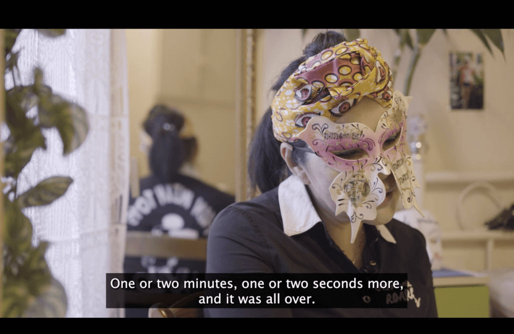
VIDEO: Alexandra Grimal (2020)
Domaine de Chambord
An inauspicious day from the get-go
My poetry has always been influenced by other artistic media, including contemporary dance, music, and audiovisuals. ‘An inauspicious day from the get-go’ is a poem with direct roots in cinema. It is affected by the simple, striking, abrupt, and contradictory visual elements in the films of two avant-garde Palestinian directors: Hany Abu-Assad’s Rana’s Wedding and Elia Suleiman’s Divine Intervention and The Time that Remains. Similar to these films, the poem explores the indifferent, banal, and haphazard genocidal violence inflicted by, and inherent in, settler colonialism; so that regular, daily acts of the colonized, like talking on a phone, or looking out a window, become extremely dangerous actions.
Through the ‘colonial encounter,’ such simple acts transform into areas within which the colonized struggle to maintain their continuity, existence, and life, as contrasted with the colonizer’s core endeavor[s] of disruption, annihilation, death. This poem touches on these contrasts of ordinary, day-to-day living, examining how colonialism obliterates them to a point of no return.
An inauspicious day from the get-go
Some damn thing made her mom start talking to her about her fiancé yet again. “He’s just not cast from the same clay we are,” she said, “and I don’t think he’s really got it in him to make it a home.”
And as always happens at such times, the young woman shouted and swore, then she hurtled—like a metal water tank hoisted half-way up towards the roof slipping its trusses to crash back down—out of the house.
In the moment between her opening the front door and slamming it behind her, a tank passed; the sound of its tracks the crushing of little children’s bones, the smell of its exhaust charred corpses.
As she crossed over to the opposite sidewalk a sniper behind her shot a young man at the end of the street, of whom nothing had appeared in the machine gun’s sights except the hair on the back of his head.
Before she raised her hand to her friend’s doorbell a bulldozer had extended its metal claw towards the walls of the next-door building, so that it crumbled into pieces on the ground.
Under the rubble a doll with disheveled hair and dusty clothes was playing some music out of her belly, next to her a notebook in which the boy had drawn what he imagined of a bulldozer destroying a house that he imagined as his own.
The boy sits silent while the woman at his side (his mother) hits herself on the head, his father having preceded him to prison. The boy will grow up one day and will love a girl who has grown up also, and then he will be betrothed to her.
The boy who got engaged to the girl—after they grew up, and he got out of prison—had been saying goodbye to her at the end of the street, and stayed there watching her walk away until she entered her house. Then he slowly walked along the street from one end to the other, passing in front of the sniper, who eventually took the decision to put a bullet in the back of the boy’s head, after the tank had gone down the street, and he’d heard the sound of a door slamming and a girl had dashed by from one sidewalk to the other, all of which he took to be evil omens, and were.
Copyright © 2025 by Hisham Bustani. Originally published in A Poem-a-Day on January 27, 2025, by the Academy of American Poets.
Translated from the Arabic by Alice Guthrie.
VIDEO: Medical placement in the Solomon Islands
Bond University
SLIDER Captures d’écran de “Doux Amer”
Equipe du film Doux Amer
SLIDER Quelques illustrations de Damien Roudeau présentes dans le film
Presentation of Destiny/Destination and reading of selected poems by Darius Kethari
Geneva Graduate Institute
SLIDER Karachi dans le viseur. Photographies de Laurent Gayer
VIDEO The Monkey in the abstract garden, Alexandra Grimal
SLIDER Three primary lines of inquiry emerged from my early image (re-)assembly
Nora Doukkali
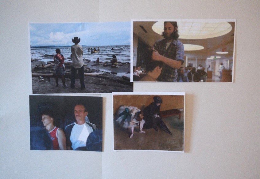
Montage 1: Waiting with, differentiated temporalities in shared waiting

It is unsurprising that waiting has a collective aspect, fostering interaction and potential solidarity. Yet, juxtaposing images like this film still from Peter Nicks’ The Waiting Room (a woman awaiting a consultation alongside her partner) and Edgar Degas’ painting L’Attente (a young dancer accompanied by a possible chaperone) raises questions about differentiated temporalities in shared waiting. How does the presence of accompanying individuals who share the waiting experience, even though they are not directly waiting for anything, alter the dynamic of waiting?
Nora Doukkali Elamajidi
Artistic collaborations with Carlo Vidoni (Destiny/Destination) and Loris Agosto (Homo Itinerans)
It was almost by chance that I began collaborating with two artists I knew from before. I first worked with Carlo Vidoni to design an exhibition entitled Destiny/Destination, which resulted in a polyphonic book bringing together interviews with migrants and poetic evocations, drawings and photographs (Monsutti & Vidoni 2023). The words we collected uncovered the vacuity of certain predefined categories: for example, the labels “economic migrants,” “asylum seekers” and “refugees” flatten a much more complex and diverse landscape. Our interlocutors spoke of their migration trajectory in terms of a tension between attachment to the places where they grew up and curiosity about the world that exists beyond the walls of their homes. These polymorphous conversations were translated into an open language that crossed the boundaries between social anthropology and visual art, between creators and the public, to reach people who could relate to the migration narratives and enrich them with their own experience. The lines on the palm of the hand were our visual and discursive starting point. They tell stories, they convey a message of singularity and, at the same time, of shared humanity, of idiosyncrasy and universality.
 I Am From Where I Am Going, Geneva, March 2024 (A. Monsutti).
Another artist, Loris Agosto, was struck by a sentence that an old man told me during my fieldwork in the mountains of central Afghanistan. I used this sentence to open the book Homo Itinerans (Monsutti 2020): “I come from where I am going!” An apparently paradoxical sentence, it is more than just a formula, it is an invitation to change our perspective and take a fresh look at human mobility. Here, social sciences inspired art through the production of sculptures in which human faces can be distinguished, without it being clear whether they are being born or being swallowed up by mud. The work was complemented by figurative texts I wrote to evoke migrants’ conditions of living and itinerancy as a way of being in the world (see more).
Alessandro Monsutti
The Garden of the (In)visible
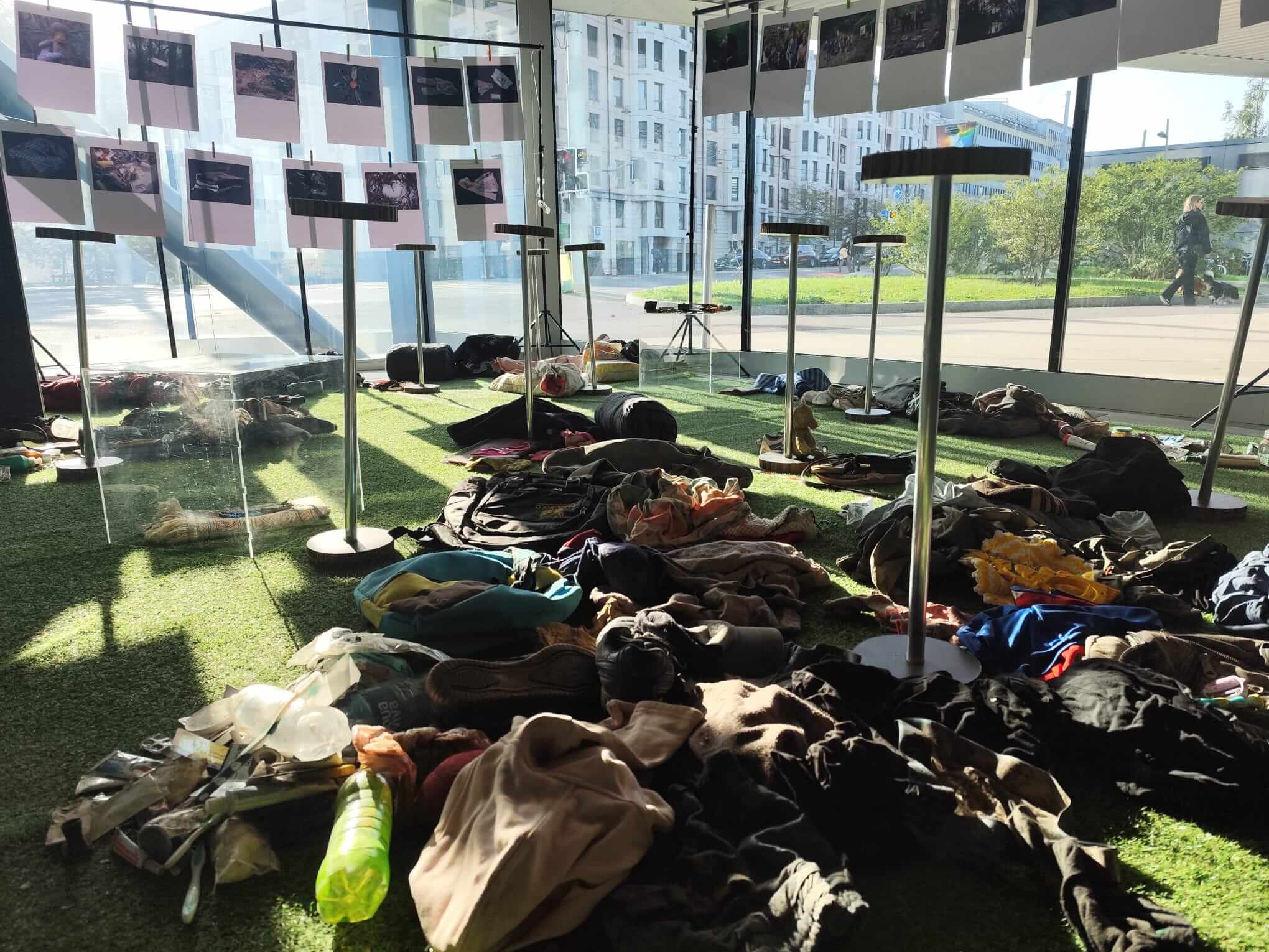 The Garden of the (In)visible, Geneva, November 2024. © Alessandro Monsutti
In line with Danto’s and Latour’s invitation to see art as a way of being and acting in the world, the installation The Garden of the (In)visible, co-created with my colleagues Roberta Altin, Giuseppe Grimaldi and Katja Hrobat Virloget, staged artefacts collected along the so-called Balkan Route, at the borders between Croatia, Slovenia and Italy. Here, objects are clearly social agents: they render visible people who were largely invisibilised. The installation was presented in public spaces and even on the streets, drawing attention to a socially sensitive situation, intentionally inviting polemic among people who might disagree in a way that participants in an academic conference would not. The process was participatory at each of its various stages: First, collecting the artefacts involved local authorities and activists, students and professors from the various universities of the region. Then, the installation was accompanied by events that brought together migrants who had taken the Balkan Route, people living near the various borders, and all those who joined the collect.
In this project, the differences between social sciences and art, but also between investigator and investigated, between curator and visitor, fade. It was not about communicating the work of social scientists to a broader audience but rather creating – beyond the narrow circle of university professors and students – a new epistemic and political community. We were modestly following Latour’s footsteps, making public debate more accessible and challenging taken-for-granted assumptions, but, more importantly, we hoped above all to open up new possibilities for action and coexistence.
Alessandro Monsutti
Hannah Entwisle Chapuisat’s current research explores how art…
My current research explores how art’s critical capacity to engage affect, the senses, and the imaginary might influence international norm evolution in intergovernmental venues, drawing on constructivist scholars Martha Finnemore and Kathryn Sikkink’s 1998 norm “life cycle” model that recognizes the role of “[a]ffect, empathy, and principled or moral beliefs” in international norm dynamics. I have found that when art is integrated within collective efforts to develop norms, it can increase global policymakers’ awareness and understanding, inspire ideational commitment, and generate creative thinking, which can all influence norm evolution processes. For example, in the context of a programme such as the UN80 Initiative – an initiative launched in March 2025 to make the United Nations more effective – art-based projects may stimulate more expansive and innovative reflection about the future of multilateralism. Rather than restricting the debate to what is financially and politically viable, art has the capacity to propose or test radical solutions that may embolden global policymakers to think bigger and perhaps arrive at more innovative visions.
Screening of Mati Diop’s 2024 film Dahomey at the CDHM (February 2025)
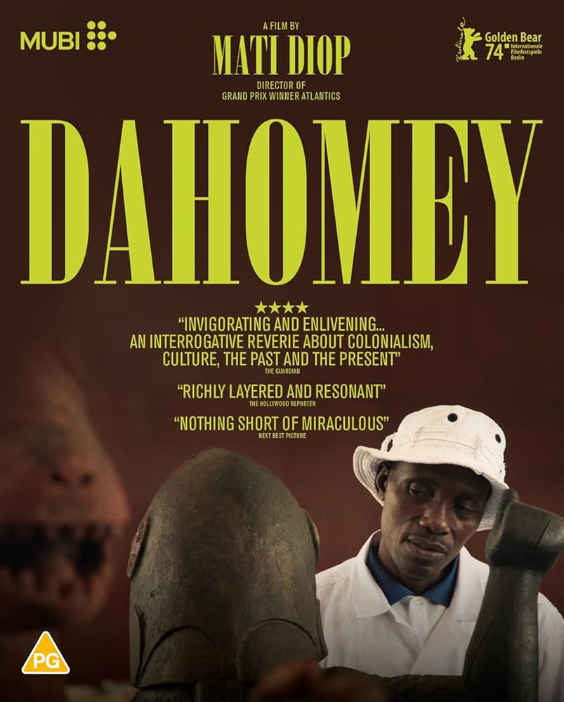
In February 2025, the CDHM hosted a screening of Mati Diop’s 2024 film Dahomey, a documentary following 26 objects from the former Kingdom of Dahomey as they leave Paris and are returned to present-day Benin. The screening was followed by a panel discussion on the “Diplomacy of Restitution: Issues of Knowledge and Powers”. Participants included leading academics, diplomats, curators and writers active in both Benin and Europe. Co-chaired by Doreen Mende, Director of Research of the State Art Collections in Dresden and Prof. Mallard, the discussion explored issues around how stolen art treasures can be received in a country which has reinvented itself in their absence. The panel covered themes ranging from the making of the film and panellists’ personal experiences of restituting archives to methods of postcolonial digitisation and digital archiving. Leading up to the event was a seminar for students at HEAD – Genève on collaborative projects on provenance research between African and Western researchers. A special session, “Within me resonates infinity”, based on the film, was held at the Museum of Ethnography Geneva (MEG) for students of HEAD – Genève and IHEID. Through the organization such multi-facetted events with a diversity of actors from different backgrounds, the CDHM hopes to break disciplinary and institutional boundaries, placing the Institute at the forefront of pedagogy on multilateralism.
Grégoire Mallard
“Image wars”, a forthcoming project by Nataliya Tchermalykh
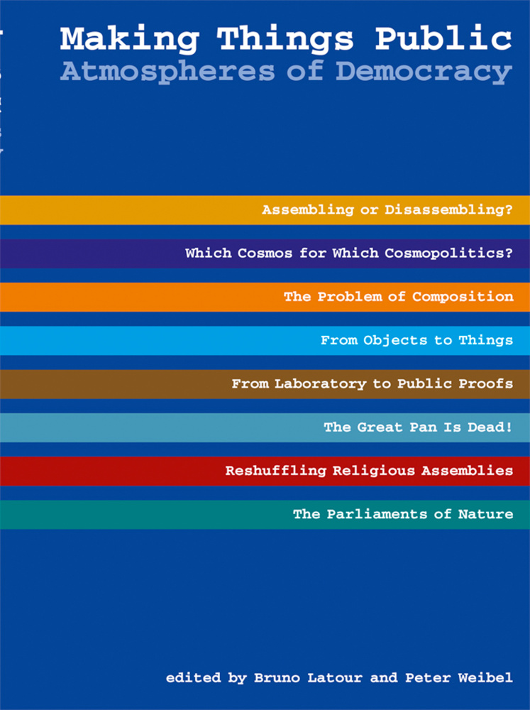
The first exhibition organized by Bruno Latour and Peter Weibel in 2002, Iconoclash, examined the: the various attempts to destroy, prohibit or indeed protect religious as well as scientific and artistic images of God, nature and man. This theme of image wars will be further developed by Nataliya Tchermalykh, a CDHM affiliate researcher in a forthcoming project. The second exhibition produced by Latour and Weibel, Making Things Public, addressed what the organisers called the “atmospheres of democracy”, pairing an impressive range of philosophers, historians and sociologists, from Europe and the United States, with visual artists. Their task: to explore the variety of media via which citizens in modern democracies voice their political claims.
Gregoire Mallard
PODCAST: Makenzy Orcel. Le sensible, la raison et la compréhension du monde
Research Office – Geneva Graduate Institute
VIDEO Member State, UN and public engagement with artwork during negotiations
Youtube / VonWong
More on my ethnography of the Tubas Cluster Plan, by Dorota Kozaczuk
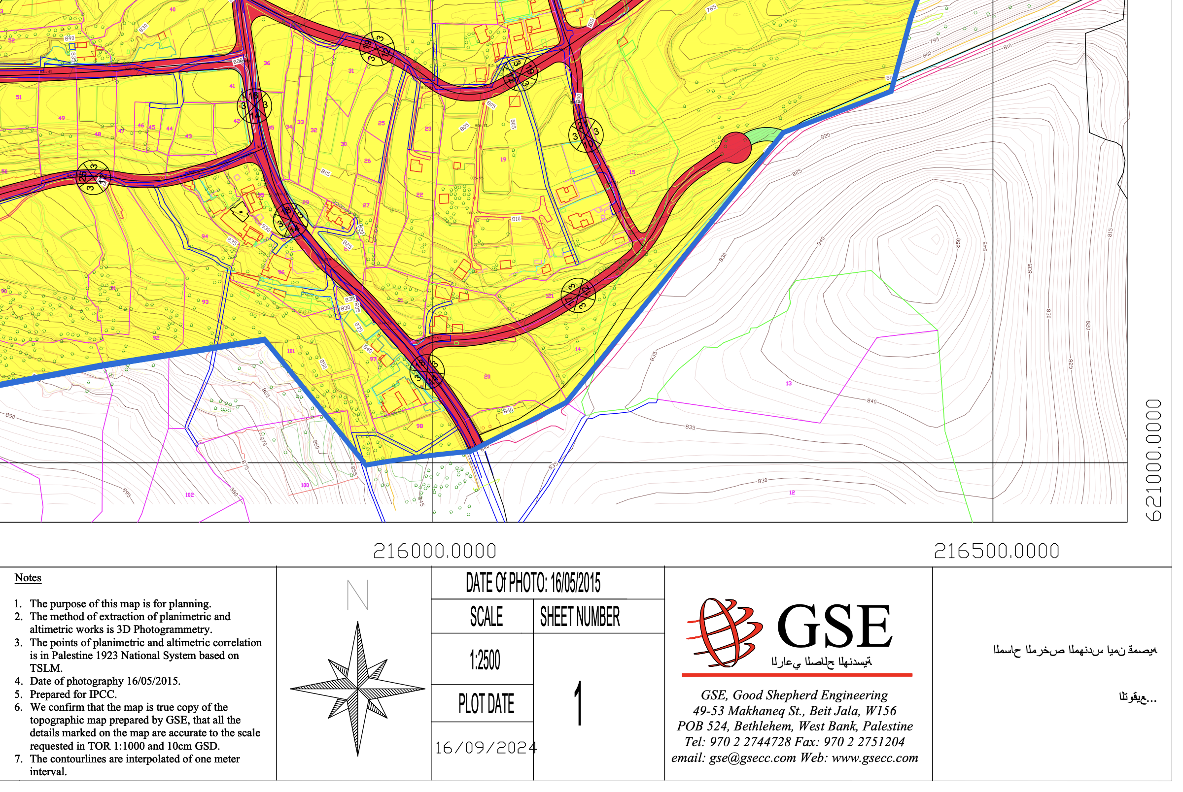
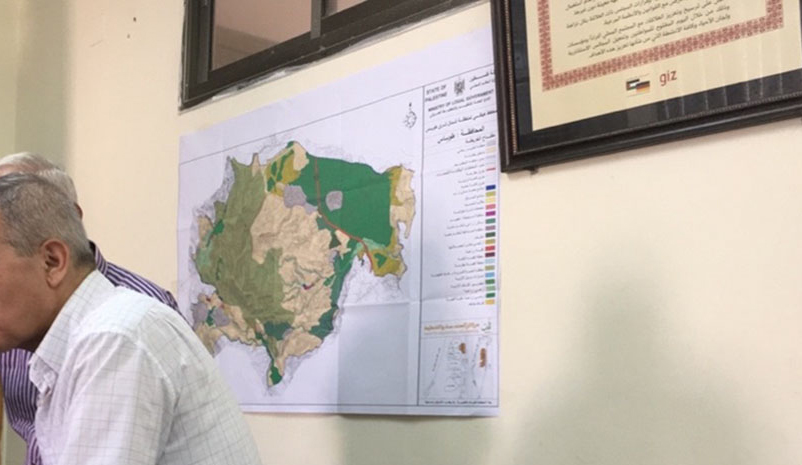
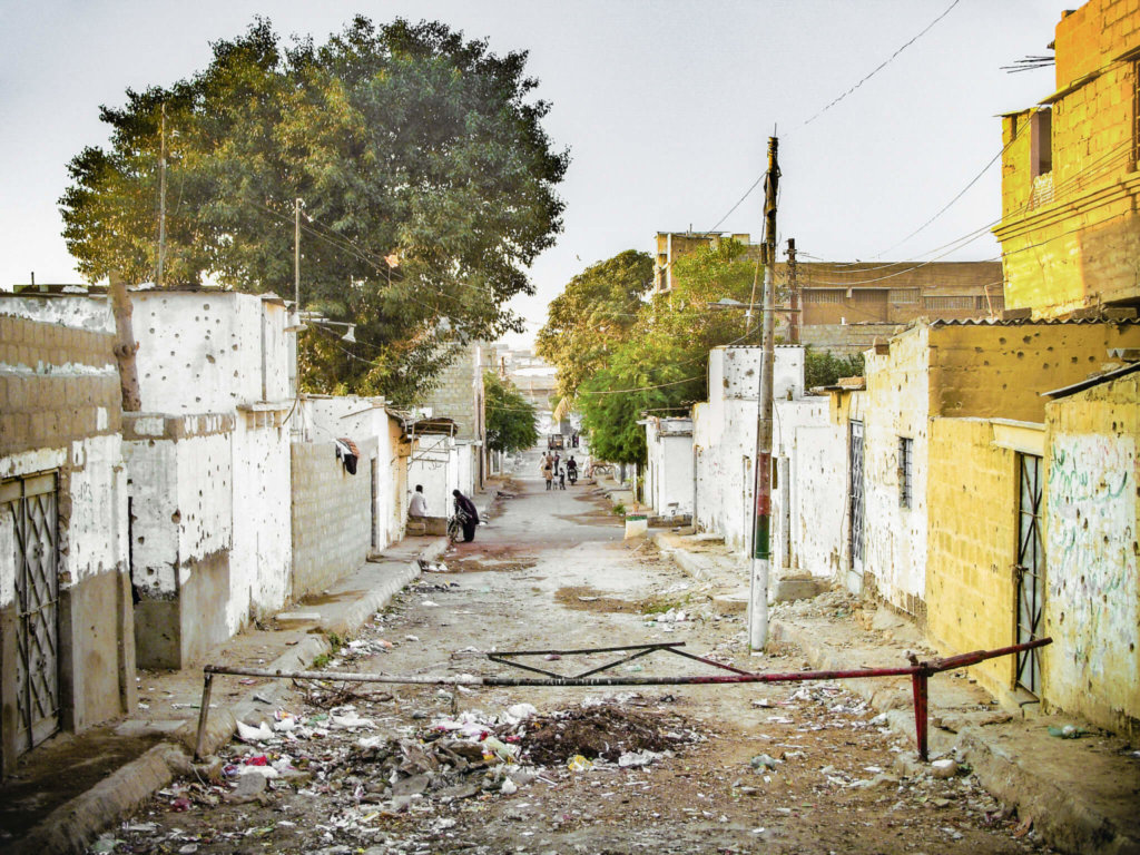
My ethnographic study of the Tubas Cluster Plan dates back to 2016, when the Palestinian consultancy CEP (Center for Engineering and Planning) began developing a regional master plan for the Tubas Governorate in the northern Jordan Valley. The project covered 118,297 square kilometres, including lands within the 1940 village boundaries of Tayasir and Bardala, as well as northern sections of Area C within Tubas city limits. Nine Palestinian communities were included in the planning framework: Al Malih, Ein al Hilwa, ‘Aqqaba, Tayasir, Khirbet Tell el Himma, Ibziq, Kardala, ‘Ein el Beida, and Bardala.
At the outset, the CEP team compiled available GIS maps, updated aerial photographs, and gathered archival data from Palestinian ministries and municipal authorities. They collaborated with a Belgian NGO and UN-Habitat as part of the project “Fostering Tenure Security and Resilience of Palestinian Communities through Spatial-Economic Planning Interventions in Area C (2017–2020).” Consultations were held with village mayors and governorate representatives, following participatory planning protocols developed by GIZ and the Palestinian Ministry of Local Government.
By 2019, during my participant observation in CEP’s Ramallah offices, four planning options had been prepared. I was shown the preferred version and invited to meetings where it was presented to stakeholders.
Aesthetic Vision and Political Friction
The Tubas Cluster Plan was visually compelling. On a printed A1 sheet, the region was divided into three zones: a deep green western section for agriculture, a faint brown central zone for mountainous terrain, and a dull green eastern area for pastoral land. Seven small zones, marked in vivid orange and bordered in blue, represented planned communities in the north, west, and east. CEP staff noted that the Israeli Civil Administration had approved plans for Tayasir, ‘Ein el Beida, and Bardala, while previously rejected plans for Al ‘Aqaba, Al Malih, Al Farisyia, and Karbala had been redesigned.
The plan proposed a road encircling the mountain range, connecting the seven communities, and included upgrades to existing roads in the west and south. Notably, it omitted Israeli settlements, the separation wall, and the military designation of much of the area. In this orthographic vision, the region functioned holistically for Palestinian life, with orchards and livestock populating the mountains and tourist routes inviting exploration. The Tubas Cluster Plan was both a misrecognition of occupation and an assertion of Palestinian reality—true to its survey methods, logically deterministic, and far from naïve.
Between Aspiration and Constraint
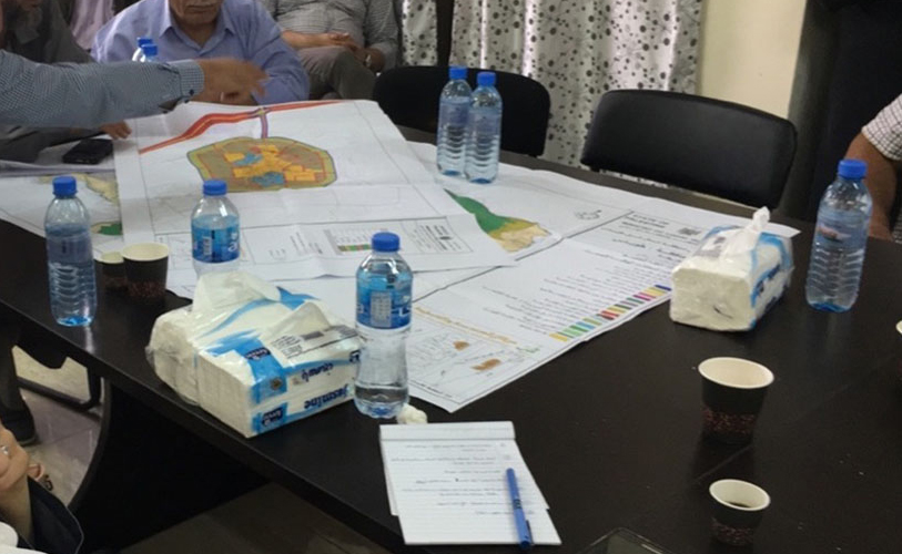
Shortly after my study, CEP submitted a report with four proposals to UN-Habitat, the Ministry of Local Government, and the Tubas Regional Committee. I attended the unveiling at the Palestinian Ministry of the Wall and Settlements. The meeting aimed to align institutional goals, but quickly revealed tensions. Ministers and engineers spoke of life near the Occupation Wall and recounted stories of displacement. One minister criticized the plan as disconnected from lived realities and questioned its aesthetics. A planner, however, defended the right to imagine beyond oppressive facts, arguing that the Tubas visualisation offered a glimpse of what that could look like.
The meeting ended without consensus. Ministerial support for a plan covering large swaths of Area C carried serious political implications: it risked undermining the Oslo Accords and provoking backlash from Israel and the international community. The plan’s aesthetic of misrecognition also conflicted with the prestige of “surveyed oppression,” which underpins legal and humanitarian support for Area C. In reality, Tubas remained a zone of daily survival under Israeli fire.
Weeks later, the CEP team presented the plan to the nine communities. At the Tubas Municipal Offices, the idea of a prosperous region was met with quiet resignation. It was deemed unachievable and received little attention.
By the end of the following month, CEP submitted individual village plans to the Israeli Civil Administration, aiming to expand them beyond Area B. These plans conformed to the aesthetics mandated by the ICA—complete with its loathed colour scheme and the infamous blue polygon.
By autumn 2019, CEP confirmed that the Tubas Cluster Plan had not been approved.
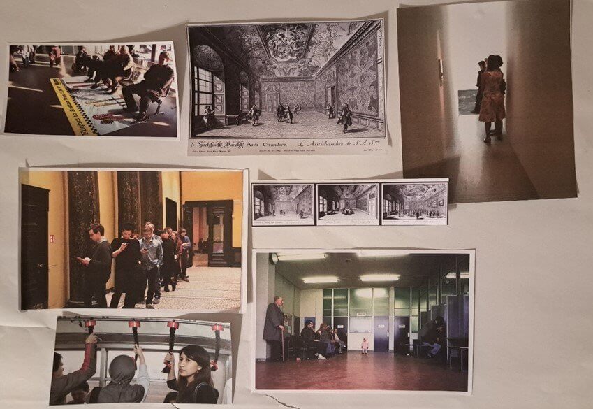
Montage 2: Spatialization of hope and frustration in public waiting spaces

When positioned in proximity to one another, images of public waiting spaces prompt reflection on how their architecture contributes to the experience of waiting. Several scholars have explored waiting as a tool of power. In this context, montages can help foster a closer engagement with how the materiality of spaces and objects configures waiting, embeds power relations and makes waiting individuals aware of their position relative to spaces whose thresholds they have crossed
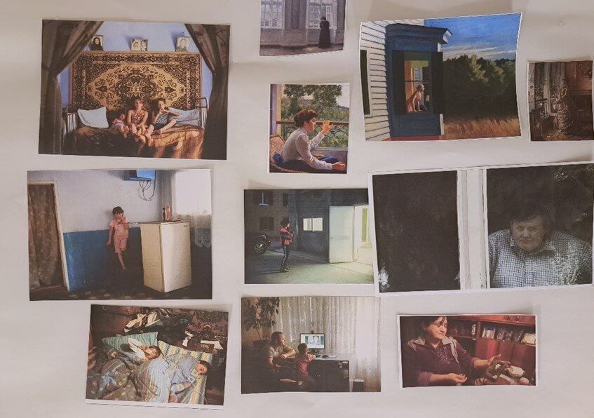
Montage 3: Domestic waiting, gender and digital mediations

The third montage questions gendered narratives of waiting and domesticity. Some images depict women as passive figures, gazing through windows that symbolize thresholds between interiors as sites of non-events and external action. When these are arranged together with Andrea Diefenbach’s photos from the series Country Without Parents, showing Moldovan children waiting by phones or computers for news from their parents who work in Italy, they offer new avenues for reflection.
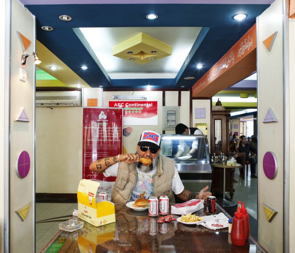
SLIDER A selection of Amanullah Mojadidi’s artistic productions


Research Office – Geneva Graduate Institute
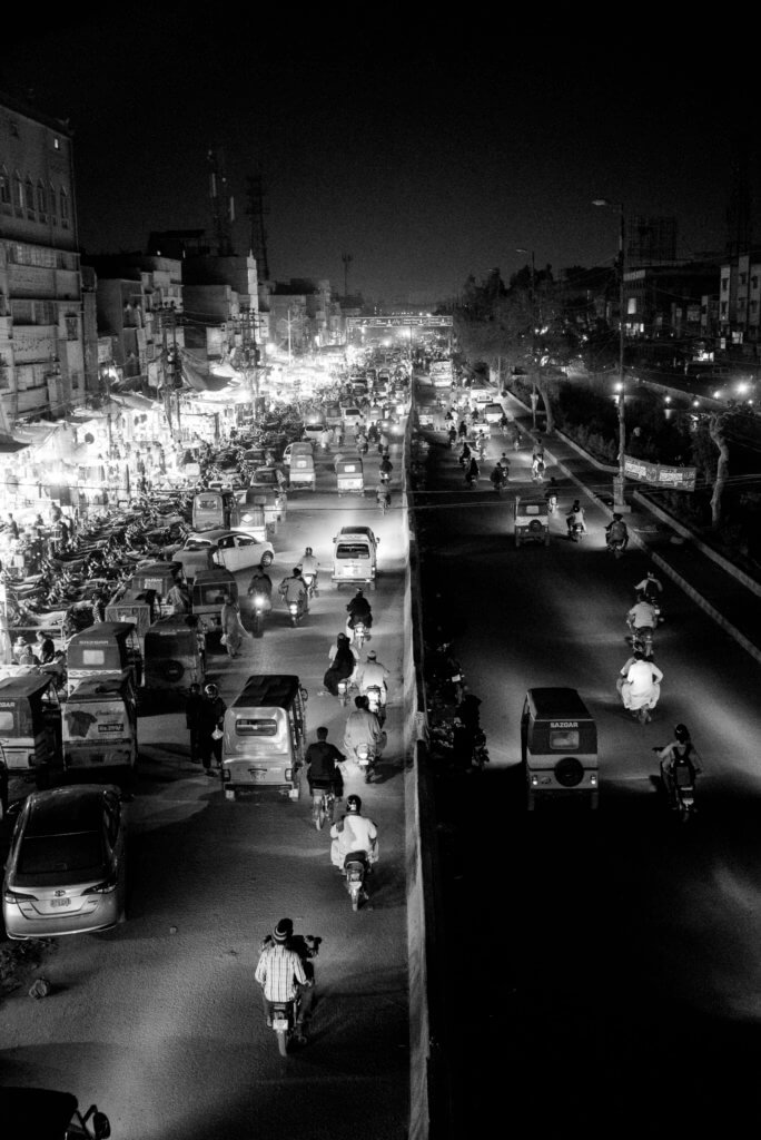
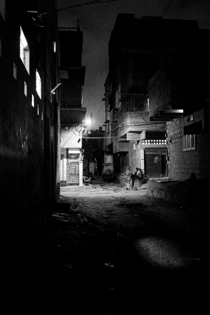
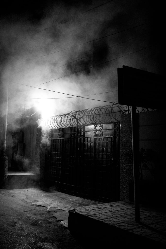
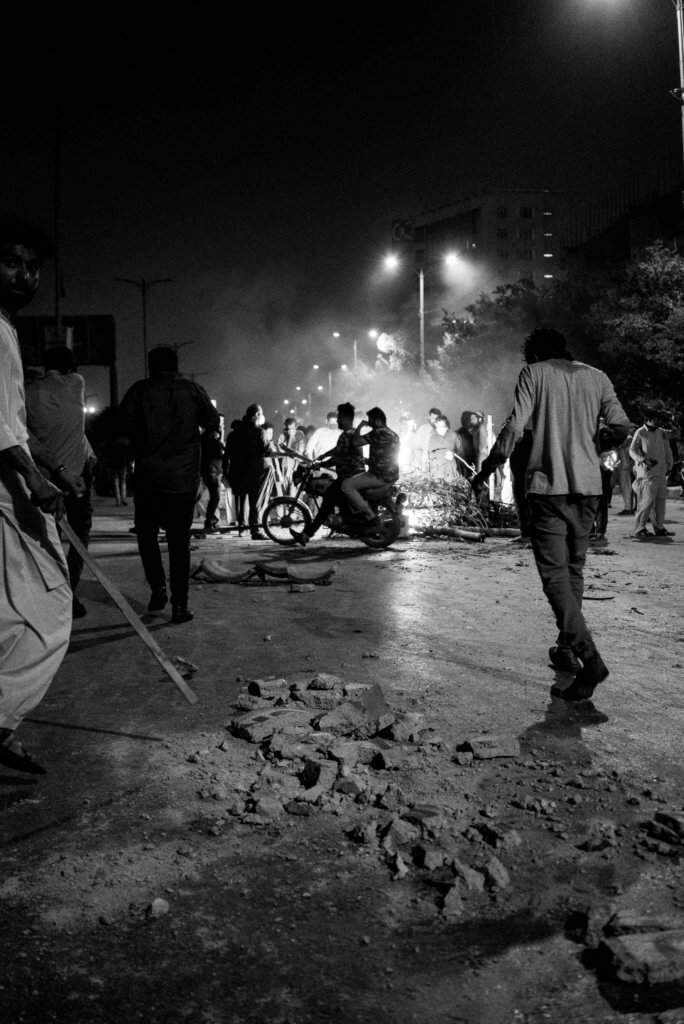
History of Palestinian Planning with maps and images
The Military Orders
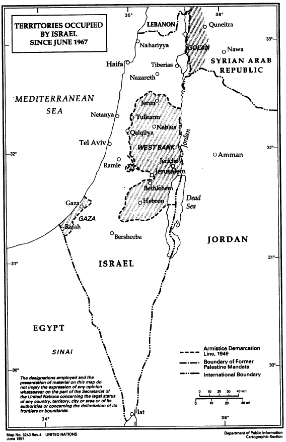 Map No. 3243 Rev 4, Territories Occupied by Israel Since June 1967, United Nations, June 1997
On 1 June 1967, the Israeli military issued its first Military Order, declaring the Gaza Strip and the West Bank as closed military areas. Military Order No. 2 imposed martial law on the West Bank and transferred all legislative, executive, and administrative powers of the Jordanian government to successive Israeli military commanders. Under strict adherence to the Fourth Hague Convention, existing laws could not be altered.
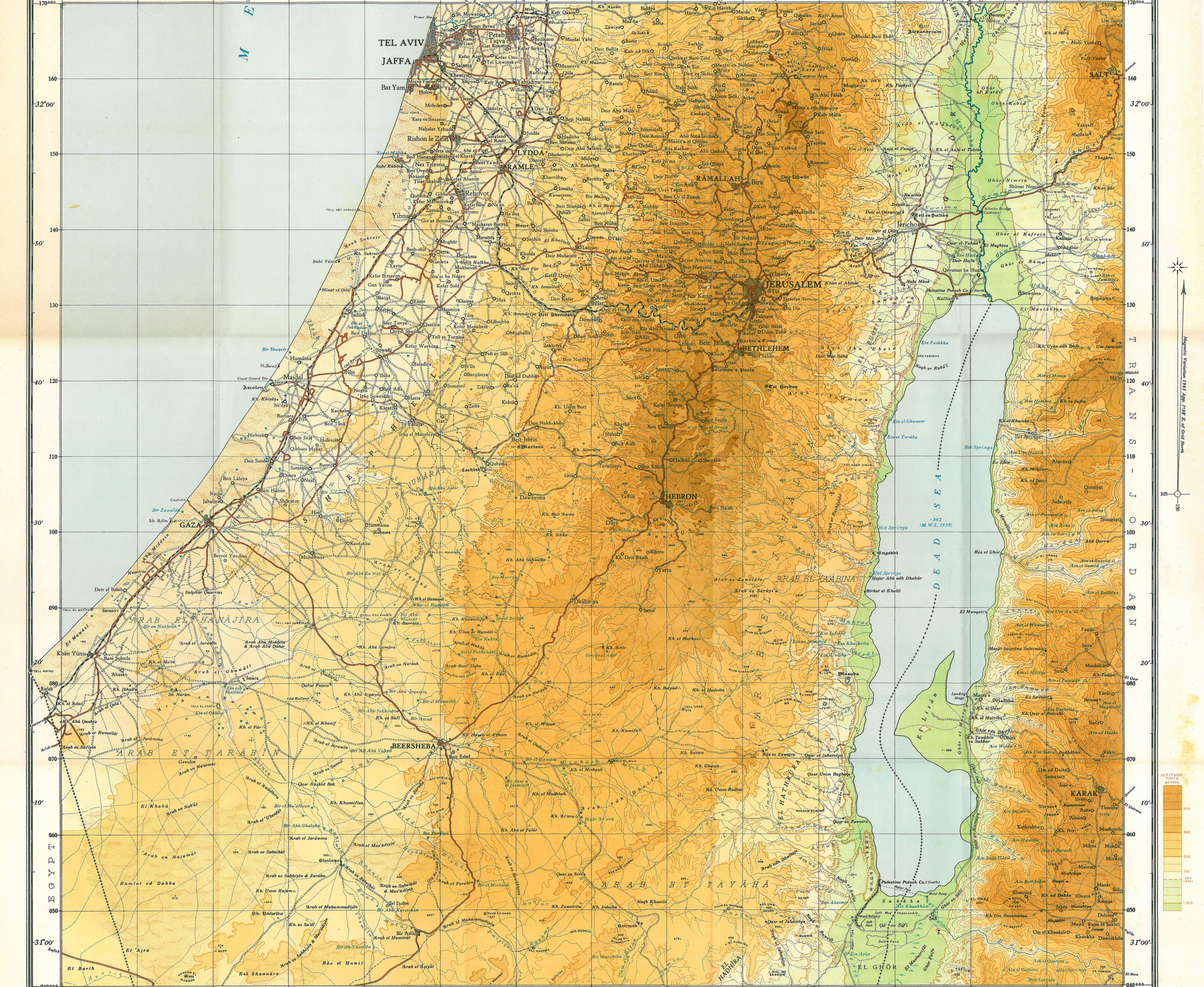 Survey of Palestine 1944, 1:250,000 Sheet 2 (partial crop).
Survey of Palestine 1944, 1:250,000 Sheet 2 (partial crop).[/caption]As the occupying power, Israel inherited maps, plans, land laws, and regulations from the Ottoman, Jordanian, Egyptian, and British Mandate periods, spanning over 150 years. Israel immediately began enforcing a stringent military regulatory regime that referenced—but never overruled—existing legal frameworks. Within the first decade of occupation, two parallel strategies emerged: the adoption of most existing laws through Military Orders (MOs), and the centralization of administrative authority under the Area Commander. Palestinians were swiftly stripped of legal and civil rights previously guaranteed under British and Jordanian administrations.
 Survey of Palestine 1942–1958, 1:100,000 maps, Survey Department of Palestine Israel enacted Military Order No. 418, titled Order Concerning the [Jordanian] Law for Town, Village, and Building Planning (1966).
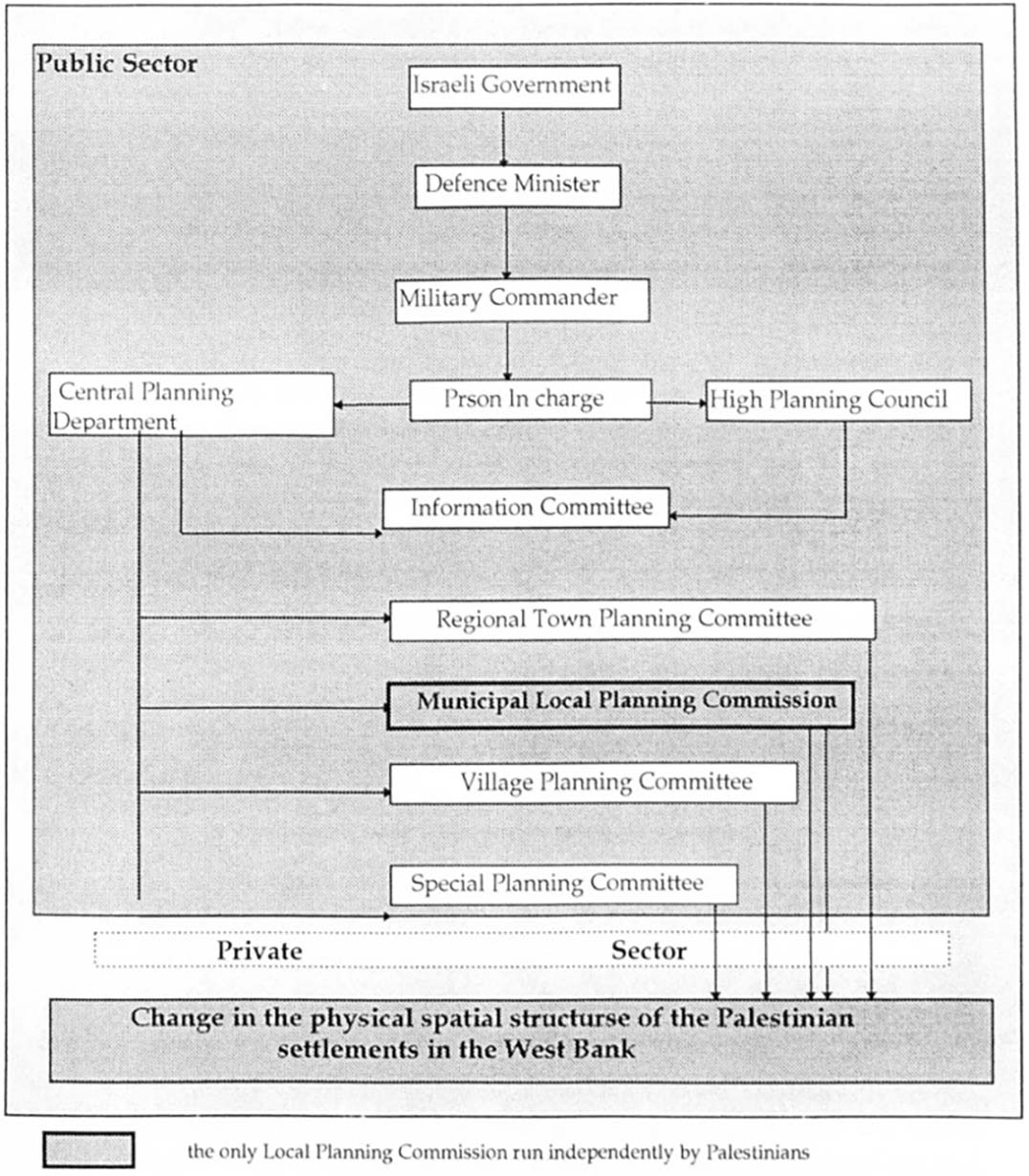 Institutional Arrangements of the Israeli Physical Planning System in the West Bank, Abdel Rahman Abdel Hadi Mahrok (1995, p.126, Fig. 8.2)
Through MO 418, Israel effectively excluded Palestinians from planning processes. Over the following decade, Israel issued additional military orders—albeit more slowly—that restricted spatial planning practices to Israeli military personnel only.
Research Office
Me, Amanullah Mojadidi. Who I am…
I received a BA in the late 1990s and an MA in the early 2000s, both in cultural anthropology. I subsequently spent the next 20 years working both as a conceptual artist and a development worker in support of contemporary artistic initiatives in Afghanistan, before returning to academia to pursue a PhD, once again in cultural anthropology. My approach in using anthropology to make art has been to listen to local communities to understand what issues are important to them and then to work with them on defining not only what to represent, but how to represent it. This approach can be seen as falling within what George Marcus has termed “para-ethnographic”, a process in which the ethnographer (or the artist) is “allied with the subject as intellectual partner in coming to terms with the understanding of a shared common object of curiosity” (Holmes and Marcus 2020:29).
Research Office. Geneva Graduate Institute